


www.goodnewsnetwork.org
NASA Develops ‘Lunar Backpack’ to Aid New Moon Explorers
NASA researchers and their partners have developed a remote-sensing mapping system set to aid explorers on the moon. It's a 'lunar backpack'.
Science & Tech
Imagine a mountaineering expedition in a wholly uncharted environment, where the hikers had the ability to generate a real-time 3D map of the terrain.
NASA researchers and their partners have developed a remote-sensing mapping system set to aid explorers in the most isolated wilderness imaginable: the airless wastes at the South Pole of the Moon.
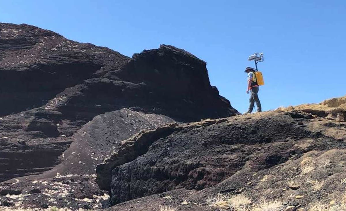
The Kinematic Navigation and Cartography Knapsack (KNaCK) is a mobile lidar scanner—a remote sensing method that uses light detection and ranging laser light to measure range.
Donned like a hiker’s backpack, it makes use of an innovative type of lidar called frequency modulated continuous wave (FMCW) lidar in order to provide Doppler velocity and range for millions of measurement points per second. These measurement points instantly create a real-time navigation system, delivering to the explorer a 3D “point cloud” or high-resolution map of the surrounding terrain.
Think of it as a superpowered version of laser range finders used by surveyors or the highly sensitive proximity alarms that help smart cars avoid collisions, said planetary scientist Dr. Michael Zanetti, who leads the KNaCK project at NASA’s Marshall Space Flight Center in Huntsville, Alabama.
“Basically, the sensor is a surveying tool for both navigation and science mapping, able to create ultra-high-resolution 3D maps at centimeter-level precision and give them a rich scientific context,” Zanetti said. “It also will help ensure the safety of astronauts and rover vehicles in a GPS-denied environment such as the Moon, identifying actual distances to far-off landmarks and showing explorers in real time how far they’ve come and how far is left to go to reach their destination.”
Probing shadow lands
That’s a key challenge as Artemis-era explorers prepare to undertake the first modern missions to the Moon, and the first ever to its South Pole. The Sun never rises more than 3 degrees above the lunar horizon there, leaving much of the terrain in deep shadow. That makes distances to various points of interest difficult to eyeball.
Initiated in 2020 with funding by NASA’s Early Career Initiative, the KNaCK project has partnered with Torch Technologies Inc. of Huntsville to develop the backpack prototype and associated navigation algorithms that permit accurate mapping without GPS.
Using KNaCK during rover excursions and when traveling on foot, explorers could precisely map the topography of the landscape, including deep ravines, mountains, and caves. Lidar even works in pitch blackness, relieving astronauts of the need to haul cumbersome lighting rigs everywhere they go.
“As human beings, we tend to orient ourselves based on landmarks—a specific building, a grove of trees,” Zanetti said. “Those things don’t exist on the Moon. KNaCK will continuously enable explorers traversing the surface to determine their movement, direction, and orientation to distant peaks or to their base of operations. They can even mark specific sites where they found some unique mineral or rock formation, so others can easily return for further study.”
That’s vital for astronauts on a clock, their excursions limited by the oxygen supply in their suits. KNaCK’s ultra-high-resolution precision—an order of magnitude greater than conventional lunar topography maps and elevation models—makes it a vital resource for conducting science and mission operations 238,900 miles away from mission control, Zanetti said.
The hardware will get another major field test in late April at NASA’s Solar System Exploration Research Virtual Institute (SSERVI) in Kilbourne Hole, New Mexico. The team previously put the KNaCK system through its paces at that ancient volcanic crater— estimated to be 25,000-80,000 years old—in November 2021.
They also used it recently to conduct a 3D reconstruction of the 6-mile-long sea barrier dunes at NASA’s Kennedy Space Center in Florida, which protect its primary rocket launch pads. Kennedy and Marshall engineers will continue to use KNaCK to assess the impact of storms on dune erosion, ensuring the safety of future flight missions as they further refine the system.