


www.cnn.com
Bomb cyclone could bring powerful nor'easter to Northeast cities this weekend
A rapidly intensifying storm known as a bomb cyclone could bring crippling winter weather across the Northeast and Mid-Atlantic this weekend. Snow, ice, strong winds and flooding are all on the table, giving rise to potentially hazardous travel conditions in those regions.
Local
(CNN)A rapidly intensifying storm known as a bomb cyclone could bring crippling winter weather across the Northeast and Mid-Atlantic this weekend. Snow, ice, strong winds and flooding are all on the table, giving rise to potentially hazardous travel conditions in those regions.
"Confidence is increasing that a significant winter storm will create considerable impacts Friday through the weekend from the Mid-Atlantic through the Northeast," the Weather Prediction Center said Tuesday morning.
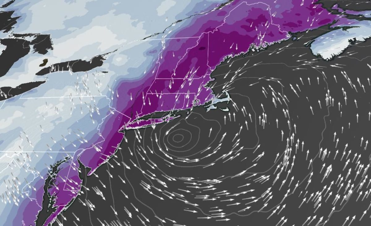
The storm is expected to move up the East Coast Friday into Saturday -- its location in relation to the coast will determine whether there's a wintry mix or a foot of snow.
Unfortunately, the forecast models are split on exactly where the low pressure system tracks and how strong it becomes by the end of the week.
It's important to note that the forecast models change daily, and there is no reason to believe that the newer model runs are any more reliable than yesterday's runs.
But despite the ongoing uncertainties, "it is becoming more likely that it will bring significant snow, sleet and freezing rain to the region, including the I-95 metropolitan areas," the Weather Prediction Center added.
The National Weather Service office in Philadelphia also reiterated on Tuesday that the current forecasts for this storm are similar to other 3-5 day forecasts of past significant storms -- a reason to watch this closely going forward.
Snow and ice accumulations could end up being significant. The weather service office in Boston also noted on Tuesday that some of the models have the low pressure system going right over a forecasting sweet spot known as the "70/40 Benchmark".
Low pressure systems tracking over this spot -- the intersection of 40 degrees North latitude and 70 degrees West longitude -- are known for being significant in the Northeast, often bringing large amounts of snowfall to the area.
If this occurs on Friday, a swath of 8 to 12 inches of snow is very likely over areas in southern New England.