


www.cnn.com
Tropical Storm Lee is expected to rapidly intensify into an 'extremely dangerous' hurricane in the Atlantic by this weekend | CNN
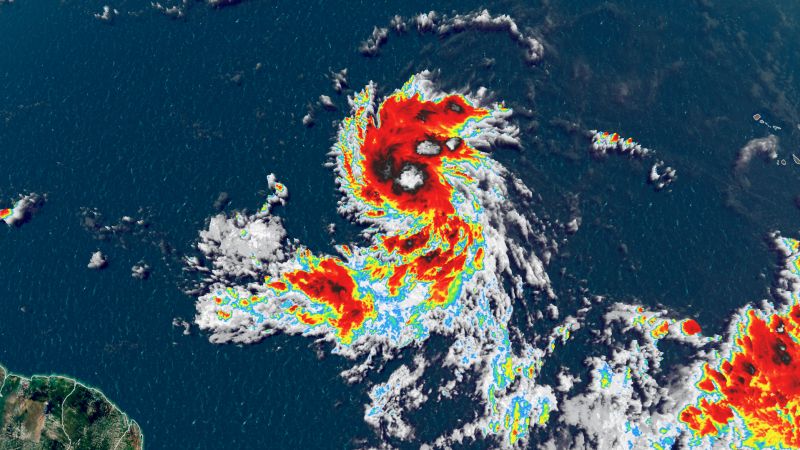
Tropical Storm Lee is expected to rapidly intensify into an “extremely dangerous” hurricane in the Atlantic Ocean by this weekend, the National Hurricane Center said Wednesday morning, as the season approaches its typical early September peak.
Local
Tropical Storm Lee is expected to rapidly intensify into an “extremely dangerous” hurricane in the Atlantic Ocean by this weekend, the National Hurricane Center said Wednesday morning, as the season approaches its typical early September peak.
Lee could become a hurricane Wednesday then a major Category 3 storm or stronger by late this week, with the Leeward Islands of the Caribbean expected to feel its impacts over the weekend, forecasters said.
“Lee is not far from hurricane strength, and it likely will achieve that status later today,” the National Hurricane Center noted in its 5 a.m. update. “While it is too soon to determine the location and magnitude of these possible impacts, interests in this area should monitor the progress of Lee and further updates to the forecast.”
The tropical storm is packing maximum sustained winds of 65 mph and is about 1,300 miles east-southeast of the northern Leeward Islands, according to the hurricane center. The islands include the Virgin Islands, Saint Martin, and Antigua and Barbuda.
Swells generated by Lee are expected to reach portions of the Lesser Antilles on Friday. These swells are likely to cause life-threatening surf and rip current conditions. Lee’s winds could reach 150 mph on Sunday evening, according to the hurricane center.
Any shifts along its track as it nears the islands could bring more of an impact there and beyond. Anyone in the eastern Caribbean – including the Leeward Islands, Puerto Rico and Hispaniola – as well as the Bahamas will need to keep a close eye on the forecast.
It’s too soon to know whether this system will directly impact the US mainland, but even if the hurricane stays out at sea, dangerous surf and rip currents could once again threaten the East Coast. One person was killed in a rip current in New Jersey over the Labor Day weekend.
Lee became a tropical storm Tuesday after forming earlier in the morning in the central tropical Atlantic and moving through extremely warm waters, according to the National Hurricane Center, which predicts the storm will strengthen rapidly.
Rapid intensification is when a storm’s winds strengthen quickly over a short amount of time. Scientists have defined it as a wind speed increase of at least 35 mph in 24 hours or less – a phenomenon aided by warm ocean waters.
As Lee moves steadily west-northwest this week, it will enter conditions increasingly favorable for strengthening: Plenty of moisture, low wind shear and abnormally warm water stretch nearly the entire length of the potential cyclone’s projected path.
“The NHC intensity forecast is extremely bullish for a first forecast, but remarkably lies below the intensity consensus,” the hurricane center’s storm discussion said. “All indications are that the depression will become a strong hurricane by the end of the forecast period.”
Lee would be the fourth to reach that status this season, following Don, Franklin and Idalia. The hurricane is expected to grow significantly stronger by the weekend and is forecast to become the season’s third Category 3 or stronger hurricane as the weekend begins.