


www.yahoo.com
Tropical Storm Kate forms far out at sea, and two other disturbances to watch
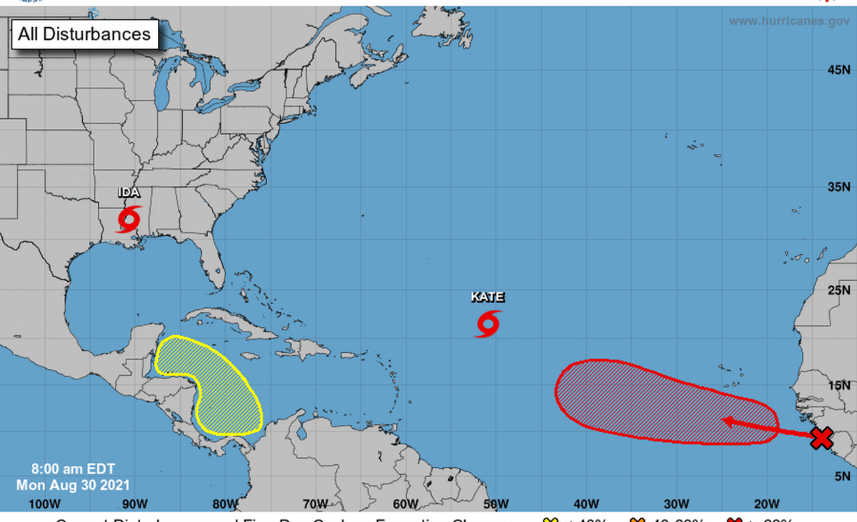
As forecasters continue to track Ida, which has now weakened into a tropical storm over southwestern Mississippi, the Atlantic remains bustling with activity.
Local
As forecasters continue to track Ida, which has now weakened into a tropical storm over southwestern Mississippi, the Atlantic remains bustling with activity.
The good news is that none of the systems threaten Florida.
The National Hurricane Center is watching the newly formed Tropical Storm Kate, which is forecast to follow a winding northern path far from any land for the rest of the week.
As of the 5 p.m. advisory Monday, the system was about 805 miles east-northeast of the Leeward Islands with maximum sustained winds near 40 mph with higher gusts.
Forecasters aren’t sure if the system will survive the hostile shear conditions long enough to get much stronger, so “significant strengthening does not appear likely at this time.”
“Assuming Kate is still around by day 5, the cyclone is forecast to become absorbed by a larger extratropical low near Atlantic Canada,” forecasters wrote in the 5 p.m. update.
As of the 2 p.m. update, a disturbance near Africa has a high chance of turning into a tropical depression later this week — 70% in the next 48 hours and 90% in the next five days — as it quickly moves west-northwest over the eastern Atlantic.
Forecasters also expect to see a disturbance form in the southern Caribbean Sea in the next few days. It could see some slow development by the end of the week if it remains over water, according to the hurricane center. The system is forecast to move west-northwest or northwest at 5 to 10 mph over the western Caribbean Sea, close to the east coast of Central America. It has a 20% chance of formation through the next five days.
Ida, which caused all of New Orleans to lose power Sunday, had weakened into a tropical depression with maximum sustained winds near 35 mph with higher gusts by Monday evening. It was about 20 miles north-northwest of Jackson, Mississippi.
Portions of southeastern Louisiana and southern Mississippi should expect to see dangerous storm surge, damaging winds and flash flooding Monday.
However, rapid weakening is expected and Ida should turn into a tropical depression by the evening.